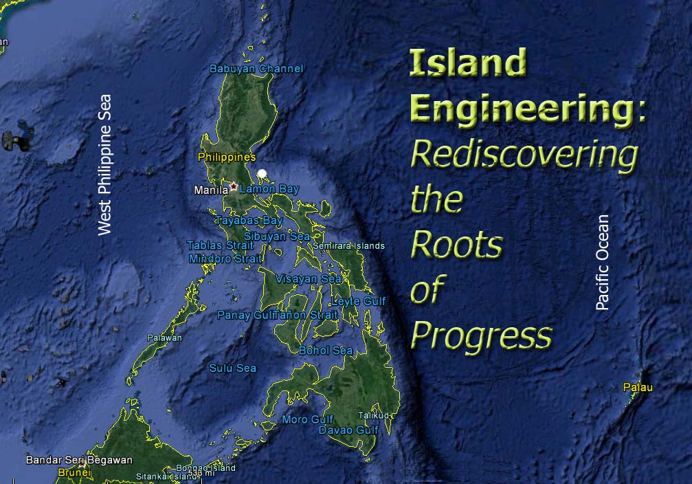
Island Engineering: Rediscovering the Roots of Progress
About this Blog (PART 1) – Introducing a New Field of Engineering (Posted 2020 March 17)
This is a book-in-writing – or it could be a manual, a guide-book or a syllabus in innovative engineering. As implied, it seeks to integrate available relevant histories, knowledge, information, methods and plans from all possible sources, disciplines, fields of study and research, including laws, statutes or codes and other accepted indigenous, cultural, private and government beliefs, practices and standards of operation to formulate, design and implement programs and projects that concern the habitability, integrity, sustainability and posterity of an island of any size whatsoever. Technical talk aside, the layman would say this is a new way of looking at harnessing natural resources using traditional, organic or natural methods from ancient times while applying essential, effective and practicable principles of modern engineering to island development. The naturalist, on the other hand, would ask: How does a person, whose life and well-being totally depend on an island, care for himself, for others and for the island itself while allowing everything (humans and the environment) to thrive and grow for many generations?
Certainly, the question has been asked. The answers, however, seem to be absent or, at the least, dispersed within the piling archives of human knowledge and left unappreciated and applied to make a lasting difference in our fast-changing and fast- deteriorating world. We can be easily mesmerized by flashy photos or concept designs of magnificent and gigantic structures vying to become the latest wonders of architecture and engineering which are supposedly meant to enhance transportation, communication, industry, commerce and habitation. Technology, the “latest” especially, has a way of distracting us from the “organic technology” that has worked for millennia without human hands and ideas tinkering with it and benefited them while allowing Nature to remain undisturbed and undiminished. But Mother Nature graciously gives in to our ways and still functions as much she can, according to her ancient ways. Until she can no longer give of herself. And who pays for her eventual failure?
For with every house or building we put up, we take from the land or the island, thus, changing everything that the land contains and supports. Cut a tree and you cut the natural support for light, water, air, soil, bacteria, insects, animals and humans that should have been maintained in order for the tree to support life and the environment the way it was supposed to achieve. Multiply that a hundred or more times on a small island and you practically kill the island. Look at a modern city. In a sense, it could also be an island – a dead island. Yes, there are humans living in it. But where are the fruits trees and their rich soil, the birds and their nests, the clean rivers and streams, the lakes and their thriving fauna, and the meadows and the grazing animals?
Could we not have built our homes without destroying all the things that made the island an island? The way ancient people did? Maybe it is too late to ask or even to go back. But we will try to answer the question and find ways to address certain problems that may help our modern ways become more responsive to the island’s – and our — well-being. That is the goal of Island Engineering through this blog.
Community-Writing a Book
Anyone is welcome to contribute to or comment on this work, whether you are a grade-schooler, a housewife, a father, a teacher, a dentist, an urban planner, a seaman, a carpenter, an architect, a professional engineer or a businesswoman. Whatever valuable input anyone might share toward forming a compendium on Island Engineering, as we will define it further here, will be a rock that will help build the foundation of a future source of information on how leaders, planners, communities and individuals can base or adapt their work and lives with sufficient confidence and intelligence to make important and well-informed decisions.
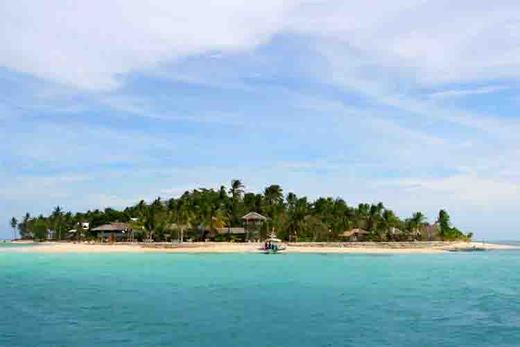
Although islands exist in all parts of the world, we will begin with the collective knowledge and experiences from one country, Philippines, land of birth and being for many of us. Having travelled and seen many of its emerald islands from the sky, on the land, by the coasts and under the seas, there is no doubt that these blessed islands possess all that a people could possibly need to live peacefully while being afforded with the freedom to enjoy the blessings of the islands through many generations. Although many natural and human-induced challenges persist and seem insurmountable, proper management using reliable and proven knowledge and technology will provide a bright promise for us to be equal to the many difficult tasks.
We now undertake this endeavor while keeping in mind our limitations imposed upon us by many unknown and unseen factors along the way. This first step in our journey gives us victory already.
If you wish to comment or contribute any relevant idea or solution to this effort, please write in the box provided below or send an email to Vince Ragay at any of these addresses: [email protected] or [email protected].
Introduction
The Pilipino people live in an archipelago composed of more than 7,100 islands located in the typhoon-and-earthquake-prone, western limits of the Pacific Ocean, sharing that distinction with such nations as Japan, Taiwan, Korea, Borneo, Malaysia, Indonesia and Singapore. The predominantly freedom-loving and exuberant inhabitants consider each island a precious pearl or gem dropped from Heaven upon the waters of Southeast Asia. The legend may seem fanciful; however, it actually describes the multi-faceted value of each island not only to its residents and their neighboring island dwellers but also to all the tiny and large living organisms that form part of the web of life and the underlying ecosystem that further sustains the delicate balance of life within this precious gem.
Managing each unique island, therefore, involves precise knowledge and skills that would push the limits of any person or group tasked with the goals of maintaining balance and checking the equitable distribution of energy and resources for every vital, living inhabitant, no matter how small, within its outermost limits. For example, the marine life that thrives around a hectare-sized island within a ring of coral reefs presents a foundational support that can help sustain the protein source for land life (as food, fertilizer and supplementary nutrients), which in return, feeds back the same benefits in the form of waste that recycles through the growth and decomposition of flora and fauna, the effects of climatic and geologic processes, such as precipitation, weathering and erosion, and the symbiotic activities of humans.
But we paint an ideal picture, one that may have occurred thousands of years ago when only a handful of islanders dwelt on these islands. Today, the picture jumps forward to a chaotic interplay of natural and artificial processes where the ultimate victor is neither of the two. No matter how the ecosystem adapts to humans, there will inevitably result a corresponding decrease in the human capacity to survive, produce and reproduce with every adaptation that humans also create that, by itself, affects further the capacities of the ecosystem. An interesting case is the role that water plays as a resource, as well as a material component in the geophysical framework of the human environment. We will dwell on this matter in order to further illustrate and clarify the approach we wish to present in this series of lessons and discussions as we define and develop the whole idea of Island Engineering into a special and general field of study or research and one that has potential practical application.
Water as a Resource
Although not considered a nutrient, water is essential to life and its processes. Nothing, not even the entire biosphere (that part of the globe where life dwells), will exist without water. The Earth might as well be Mars or the Moon without water. Our planet is blessed with and has definitely been blessed by water, beyond the fundamental or organic meaning. Plants, animals and humans are more than 70% water, by weight alone. Water is practically a fuel more precious and more vital than oil. Without the continuing cycle of water as the dynamic backbone of the ecosystem, we would have no ecosystem to talk about, no biology, no life whatsoever.
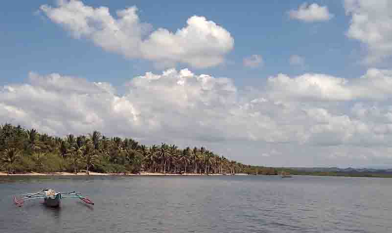
In our effort to define Island Engineering, therefore, water will serve as a good starting point and process-flow determinant, so to speak. How and where it flows, literally and figuratively will guide us well in our task of creating a working model for every island. After all, an island is basically a piece of rock-and-soil material surrounded by water but is, in itself, invaded by water and is, in fact, dependent on water for its development as a productive, thriving island. An uninhabited rock can be an island as well; but it can still have life of some form that is somehow viable. Preserving and enhancing that life is part of Isle Engineering. Moreover, exploring the tiny island and discovering its secret nooks will contribute to our overall view of the scheme of things. For ultimately, while we may study a particular island, we also have the goal of studying the whole archipelago as one and how it relates to that island, for its coastlands and water currents somehow affect other islands and dwellers. For instance, did you know that seeds of various plants, coconut in particular, colonize other islands by floating and travelling long distances before germinating and growing into maturity? In a way, that is natural Island Engineering at work! No island is an island.
In the greater picture, water can sustain the life of a vast variety of life in an island that requires humans to step into the picture to provide the lead in addressing the challenges and needs of every aspect of that life. “Subduing the land” roughly, but ultimately, defines the purpose of Island Engineering. For God did not make islands to keep them to themselves, sustain life, grow food and to feed nothing but mere “creeping things”. Then the greater mystery that needs solving is why humans exist at all and why many of them live on islands! So, we are in for an exciting search for vital answers. Looking at a map of the Philippines may dampen such childish enthusiasm. For an island the size of Luzon or Mindanao presents us with greater challenges than would an islet.
How water is harnessed, stored, distributed, utilized and disposed of takes the bulk of the tasks of what Island Engineering must address in order to ensure that this vital resource is made available to all island dwellers in sufficient and economical amount, where they need it and in a condition or quality that is most conducive to their survival and sustenance. The various fields of sciences and engineering already provide presently the compendium of knowledge and technology that together seek to solve issues and create programs and mechanisms that resolve them in efficient ways. Mountain dams, for example, help to store rainwater for our water supply needs. These dams also generate electricity to run our industries and homes. Water treatment plants make water potable for humans; and sewerage treatment plants, in turn, makes wastewater safe for the environment as it flows out. Although our water distribution systems are a limited, artificial construct integrated into the longstanding and pre-existing natural water cycle that has functioned since the beginning, it is one of the most efficient and affordable methods we have so far.
A process, though not perfect, can help us in many ways. But do we stop there? Can we innovate on it? Can we totally tweak dams in order to come up with one that may also be imperfect yet less destructive, less costly and more reproducible? These are some of the questions Island Engineering must look into.
(Map and photo above courtesy of Google Map and www.google.com, respectively.)
ISLAND ENGINEERING (PART 2) – How Water Formed the Earth (Posted 2020 July 30)
Water also as Geophysical Agent
Beyond providing sustenance for biological life, water plays the more expansive role as geophysical agent. Aside from the rhythmic tidal and wave actions that an island’s surrounding sea produces continually, aiding in weathering, erosion and displacement of soil materials and vegetation, we must consider the important effects of precipitation on an island.
When rain falls upon an island, say near the shore, the water retention time on the land and into the soil is much lower compared to that of rain falling on top of the mountains. Water that percolates into the ground could remain there for years and decades. Removing the effect of evaporation, the amount of water that falls upon the land is practically the same amount that the sky has given. The land has no more desire to keep water to itself than the sky has to keep it for itself. Both the land and the sky are servants of the Sun!
The so-called “channels of the deep seas” can be said to also exist as “channels in the sky”, which are no better or bigger than the river channels that meander down to the sea – because they are one and the same. Though we see rain fall in “sheets”, it actually does so as individual drops when each tiny dust of “rain-parent” attracts water-vapor molecules to condense as a raindrop. But once the drops reach the land, they cease to be separate drops and join the stream of water as one flowing body over the land. Through a gaseous fluid (air) which allows it to freely fall and to catch ions, aerosols, microorganisms, toxic elements, insects and colloidal pollutants, water effectively works as a sieve to cleanse the atmosphere and to restore it into a fresh, clean working-room in which life-giving gases can once more reclaim their space to rejuvenate life any place they can reach — in our lungs, in the trees, in the sky and in the crevices of the land.
And so, the land once again breathes in the new air, giving out oxygen, carbon dioxide, methane, sulfur, hydrochloric sulfurs, bacteria, viruses, dust, gases and aerosols. But the rainwater has likewise fed the land with new water while allowing the land to breathe as it should (through the gases that rain carries into the soil). Water is not only for drinking; it is also for renewing and transforming the land in small and gigantic ways. This is just the start of the water’s journey to the ocean; yet, we have seen how much is already happening before it even flows.
The microbiological processes provide Island Engineers work on determining how water acts as a solvent, a carrier, an energy source or semiconductor. All these will help us appreciate water’s many inner cycles within the bigger cycle we will picture here. And from there, we can see how we may be shortchanging other organisms through our “artificial water-cycle” projects. Dams may give humans water, electricity and food; but we could be starving, strangling and even drowning other lands and animals, and, in fact, other people, animals, plants and even ancient human cultures. Perhaps, it is truly time for a less-destructive alternative.
How Condensation Really Works and its Engineering Value
We have to retrace our steps in our journey with water. At a certain temperature called the dew-point temperature, water vapor in the air condenses and forms molecules of water, from 10 microns to 5 mm on size, to form clouds which could eventually fall as rain. To understand the basic process, let us take a cool bus ride.
Riding an air-conditioned bus in these tropical isles during the hot season, we feel fortunate to be inside rather than outside. If we tilt the air-con vanes toward the window, we will see, in a matter of minutes, water globules forming on the window pane, out-side. By and by, each globule becomes so heavy that it slides down and joins another below it and they join other globules in their path and form a trace of “tears” on the window, like a tiny river streaming along simultaneously down with others to form an actual sheet of rain before our eyes. What just happened is almost exactly what happens when it rains.
The cold interior of the bus brings down the temperature of the glass pane to cause the warm air outside (or, at least, the thin space right next to the cold glass surface) to reach the condensation level (16o C). Tilt the bus window to simulate the actual conditions in the sky — hold on to your seats! The glass will now be the level where water vapor turns into liquid and drops as rain. Beforehand, however, we need cold wind coming from the mountain to cool down the warm, humid air hovering over the heated land. During the rainy season when the Sun has heated up the land enough so that, usually by afternoon, so much water has evaporated and formed thick, heavy white clouds, condensation can produce the same domino-effect that one globule triggers on the glass pane and cause rain to fall in torrents.
From our two-dimensional example, we now have a simple 3-D view of rain. Multiply that a million times and you get cats and dogs! However, this process happens all the time – each night when dew forms on the leaves, each time we turn on our air-con or each time we cook rice or boil water. Even the leaves of trees can form dew in the daytime. The amount of water moisture hanging upon the land is an untapped source of sufficient water to fulfill certain personal and household needs. It is practically a gaseous dam waiting to be utilized. In the arid regions, people once built “air-wells” which harvested water vapor for drinking and watering plants. Again, our “artificial-water-cycle” projects have robbed us of many opportunities to develop grassroots-methods that could serve small to medium-sized communities – or a whole sizable island!
What prevents us from building so many air-wells (mini water-farms) to collect moisture at night and using that pure water for drinking and for watering house plants? The trees in the forests do it to water themselves, besides depending on rain at times. An archipelago has the added advantage of having water around islands and, therefore, sufficient evaporated moisture that is blown inland by the sea breezes during the day. At night, the cool wind blows down from the hills and condenses the moisture over the land as dew or rain. Many of us know this! Or do we? Should it only be the scientists, engineers, weather reporters and teachers who have any stake on this know-how?
Island Engineering now puts a stake on this small, simple knowledge to find ways to understand more closely, to adapt accordingly or to innovate on the process for an island’s benefits. And it follows, for its dwellers’ benefits. Cloud-seeding has been one of the steps taken to address drought problems in these islands. Is it the only recourse? Are we already doing some things that hinder, prevent or enhance Nature’s ways in this aspect? What other undiscovered truths or unremembered memories have we missed so far?
Our journey proceeds as we find more exciting, potential vistas in our path.
Primordial History Review
We take an interesting detour in our journey to primordial and pre-moral history, when everything was literally GOOD, including humans and animals.
The beginning. Garden of Eden.
The Bible states that before there were humans to take care of the Garden of Eden, the place was sustained by a mist that “went up” and “watered” the plants. At that time, it had not rained on the Earth. Clearly, we can see this primeval condition as quite different from what we have today, or what the ancient people after the Flood saw then. For later on, King Solomon would accurately describe the Water Cycle Process when he said, “To the place from which the rivers come, there they return again.” (Eccl. 1:7)
The first time it did rain was when the Great Flood of Noah came. We all know the story, although some take it with a barrel of salt. But let us just take the prophet’s testimony at face-value and consider the effects of what he wrote; for beyond the simplistic tale and the naïve notions of many people, great truths are indeed hidden that provide a more plausible, if not the only sensible explanation for the geologic history and realities of our planet.
When the Earth began, its Creator enclosed it or submerged the whole globe within a double water-sphere. That is, the whole planet was flooded, while another water sphere or bubble lay beyond a “firmament” – what many assume as the sky or atmosphere – that may have been liquid as well, although some believe it was solid (“firm”) while some believe it was vapor. We assume the planet was generally-flat all over the globe or, perhaps, only had low hills that did not break through the layer of covering water then, because the Hebrew word used means hills, not mountains.
What may have happened next presents a process that not many have heard: The young Earth suddenly expanded due to the intense pressure contained in its depths, since its density then in the beginning was much greater than it is today. What triggered the sudden expansion is unclear, although we can consider a couple: a large meteor hitting the globe and cracking it to such depths that pressures were released – possibly explaining the presence of the Pacific and Atlantic Trenches, where magma today constantly flows out from the abyss, breaking the planet’s crust or surface further apart according to the classic Plate Tectonics Theory. Other trenches exist all over the planet surface. Others claim that powerful electromagnetic forces from the Sun caused the interiors of the Earth to resonate electromagnetically and cause the cataclysmic conditions to produce the expansion.
A New Geologic Paradigm
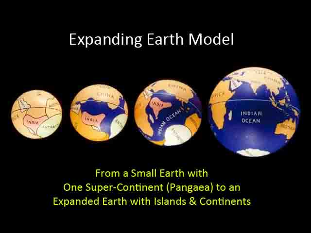
So, here now, we present a “new” theory (only about 200 years but has a growing number of adherents) in contrast to the one popularly accepted by geologists, scientists, academicians and ordinary folks. The Expanding Earth Theory presents plausible geologic and scientific facts that better explain how the continents came about. Let us look at it for a while.
Taking up from our review of primeval history, the globe remained flooded until an initial expansion brought out the land, apparently what many label as Pangaea – “Then God said, ‘Let the waters under the heavens be gathered together into one place, and let the dry land appear‘; and it was so.” (Gen. 1:9) The water broke apart as a gigantic continent and its low hills rose out of the flood. Logic tells us that the flood waters would have no way of “receding” into the Earth that is precisely expanding and giving off pressure. More in point, the gigantic twin-cracks that eventually formed the Pacific and Atlantic Ocean Basins may have provided the space for containing all the floodwaters, along with giant lakes within Pangaea, serving as precursors of later oceans when the second major expansion would come.
In essence then, the continental ridges served as the first major river system that fed the whole Pangean continent, along with small and minor river systems that may have fed the giant “twin-rivers” formed by the Pacific and Atlantic trenches. Or, we can surmise that they were effectively not rivers but lakes or water reservoirs shaped like rivers and were, in reality, strips of oceans. They could have been super-heated reservoirs that facilitated the evaporation of water and the formation of “mists” to water the whole land. That is, a quicker Water Cycle could have existed back then. It could have been the main reason why the whole globe had a sub-tropical climate initially, as attested to by remains of animals and vegetation in the permafrost in the Arctic and Antarctic regions, as documented by Velikovsky in his books.
It is quite telling that our Creator would actually say “Let the land appear” and not “lands” for it would have meant that right in the beginning the continents already existed. Yet, even classical geologists admit the validity of a one-continent world then. At least, we can all agree on that one vital point. But the following scenarios (in PART 3) will separate the men from the boys.
(Video above courtesy of www.YouTube.com.)
ISLAND ENGINEERING (PART 3) – Second Major Expansion
With Pangaea now existing, including a great lake or ocean system and the rivers that flow into or through them, we now wonder how the present continents came about. The Bible speaks of a time in the past when all people spoke one language and, at one point, were bent on building a tower to the sky. Could this be telling us that those people and others who lived before them originally lived on one single continent and were only separated when Yah scattered them over the face of the world? That the time from Adam to Noah was the period when Pangaea existed? Here is the possible scenario below.
When Yah sent the Flood, He allowed another major expansion that caused the remaining water sphere, the one above the “firmament”, to fall as part of the water that covered the whole globe during the Great Flood. Some of the water came from the interiors of the Earth as it suddenly expanded within this period. That second major expansion broke apart Pangaea into several continents and small masses of land, as well as giving us the deep oceans and the tall mountains that practically ring the Asian continent along the equatorial belt probably due to the increased centrifugal forces caused by an enlarged planet.
Moreover, mountain ranges and volcanic belts formed around the margins between the oceanic ridges and the continents. That is why we have the “belt of fire” on the eastern edges of Pacific (Japan, Okinawa, Philippines, Malaysia, Indonesia, Papua New Guinea) and on the opposite western edges (Argentina, Mexico, California, Washington, British Columbia and Alaska). These areas are also prone to earthquake events, a fact that Plate Tectonics adherents explain by the active “drifting” of the continents. Expansion theorists explain it by a mechanism that is generated by an ongoing expansion that is manifested by the release of magma and, thereby, continually replacing the oceanic-basin floor with new materials just as it did during the building of the first oceans we described above and not merely through deposition of sediments through eons. Read Velikovski’s books to convince yourself that a worldwide flooding (or several – we mentioned two main events) produced the present geological features we see today.
The uneven generation of new rock materials from both major rift systems (Pacific and Atlantic) produces a possible imbalanced lateral displacement of the Earth’s crust, thereby, causing the “collision” of the continents and the oceanic basins. It seems that the Pacific Trench has had greater amounts of materials expelled to create the vast Pacific Ocean than has the Atlantic Trench had to form the narrower Atlantic Ocean. This imbalance provides a more plausible and acceptable rationale for the existing geologic processes than the Subduction Principle of Plate Tectonics. Claiming that the Pacific Plate subducts (or dives under) under the Asian Continent and recycles itself as magma to form the boundary’s volcanic belt-system simply defies simple laws of Physics. Is it rather that the more ancient and more dense continental plates would remain steady at the advance of the much younger and less dense oceanic basin and, thus, formed new mountains and volcanoes as a result of the friction and collision of those two uneven materials? Subduction has never been completely proven to occur. Nor has recycling of the crust into magma. Although this new alternative process we present is slow and seems imperceptible, imagine what it could have done in a matter of days, weeks or months. The Great Flood period lasted exactly one year. What Noah Family saw after was a literally new Earth. Indeed, cataclysmic geological events favor a more logical and sensible explanation, which is happily consistent with biblical evidences, in contrast to an eons-long Sedimentation/Subduction/Mountain-building cycle espoused by most geologists today.
If the first expansion sufficiently explains the actual production and presence of Pangaea (sorry, classical geologists have no better alternative as they merely assume Pangaea, minus a pre-flood-covered primeval Earth), then the second expansion also sufficiently explains the production and presence of the continents that appear like precise, broken pieces of a giant jigsaw puzzle. One basic mechanism neatly explains both events. Plate Tectonics Theory loses 2-1! In fact, if one inspects the waterless surfaces of the Moon and Jupiter, one will find ample evidence that Earth or Planetary Expansion Theory explains the geologic features that an expansion process produces. Unfortunately, our oceans have totally erased all that evidence on our planet. Thanks to Galileo and the telescope, we have the final, conclusive proofs to show the Earth, the Moon and the planets were indeed much smaller in the beginning. The Earth, as estimated, had a radius of about half of the present. And that is also why it revolved faster in the beginning, as proven by the previous 360-day-per-year cycle found in historical and archeological records.
Remember our primeval tale of Eden? The mist that rose up from the land (Pangaea) was what a smaller Earth could only afford, for it had a much thinner and, thus, lower atmosphere that could not allow clouds to form yet. Besides, there were no vast seas and oceans to feed a water-cycle mechanism that required hills and mountains. (And that is why the slow, eons-long process of Uniformitarianism could not have produced Pangaea, or the continents.) All these things add up. But what caused the mist to rise and condense?
Imagine a generally-flat Pangaea with nothing but plants and some small bodies of water and narrow oceans at opposite sides of the small globe. The ancient plants were gigantic and had enormous leaves. Sequoia trees today would be but dwarves beside them. A wide forest of such trees and plants would readily attract dew in the morning and produce enough water for itself and to contribute the rest to form rivulets and streams of pure, fresh water to water the Garden of Eden. If your lawn can keep the ground wet enough to soak your socks, what can thousands of giant cedars, oaks, pines, elms, mahoganies, sandalwoods, aspens, ebonies and other giant shrubs and bushes do to a small patch of Pangaea?
We tell this story to show that our paradigm for explaining and predicting geologic processes needs a total overhaul. Predicting earthquakes and other catastrophic geophysical events (Climate Change?) based on a faulty theory will result in, well, faulty results. Our picture includes biblical, hence, truthful and reliable evidence of how the Earth began and how it might have progressed more logically and scientifically from that beginning. Without this concept we present, we will remain blind to certain realities that continue to baffle us: chaotic climate disruptions, ice-cap melting, el niño/el niña weather cycles, earthquakes, eruptions and even solar flares. Neither are we using Scriptures to prove our science nor vice versa. Both are in agreement because they have the same Source and Designer. It is when we reject the revelation of the Creator that we end up “envisioning” an Earth and a Universe that is inconsistent with the inspired record. Our job here is to avoid taking that failed path.
Islands, from our discussion above, are more recent geological features compared to continents. Even their very locations can tell us so much as to what may have occurred in the distant past. Knowing all this and having a clearer mind and a more accurate perspective, we can now proceed with our journey from where we took off on a detour.
Water, Water Everywhere
Water is one of the most volatile or active materials known to humans; and its workings and effects are so apparent to us and so intimate, in fact, that we practically swim in it, sail on it, fly through it, drink it, inhale it, exhale it, perspire it, excrete it — and what else do we do that does not involve water being a part of it? The whole face of the Earth has been carved out by water with the participation of other matter and forces; hence, its role can neither be overemphasized nor neglected.
For once water has started its earthbound task of watering vegetation, filling the lakes and rivers, supplying the essential needs of humans and animals for water and all other tasks it must do, it ends up in the great reservoirs of the seas until the Sun calls it back again to retrace its way back on its tireless journey.
Have we ever wondered why this is happening? Or why almost everything in the Universe merely circles back to its origin and repeats itself? As if nothing ever changes – and yet nothing remains the same entirely, from the human perspective. No matter how we try to solve a certain problem, such as flooding, typhoons or earthquakes, we never find the perfect or fool-proof solution to it. As if we never learned our lessons throughout the centuries and the generations of people who have lived on this planet. Do we merely wait until our civilization gets overrun by a cataclysm and submerged in mud or lava until a new one unearths it after a millennium or so? Can we finally break that pattern?
We keep trying and keep learning. Hence, this present task.
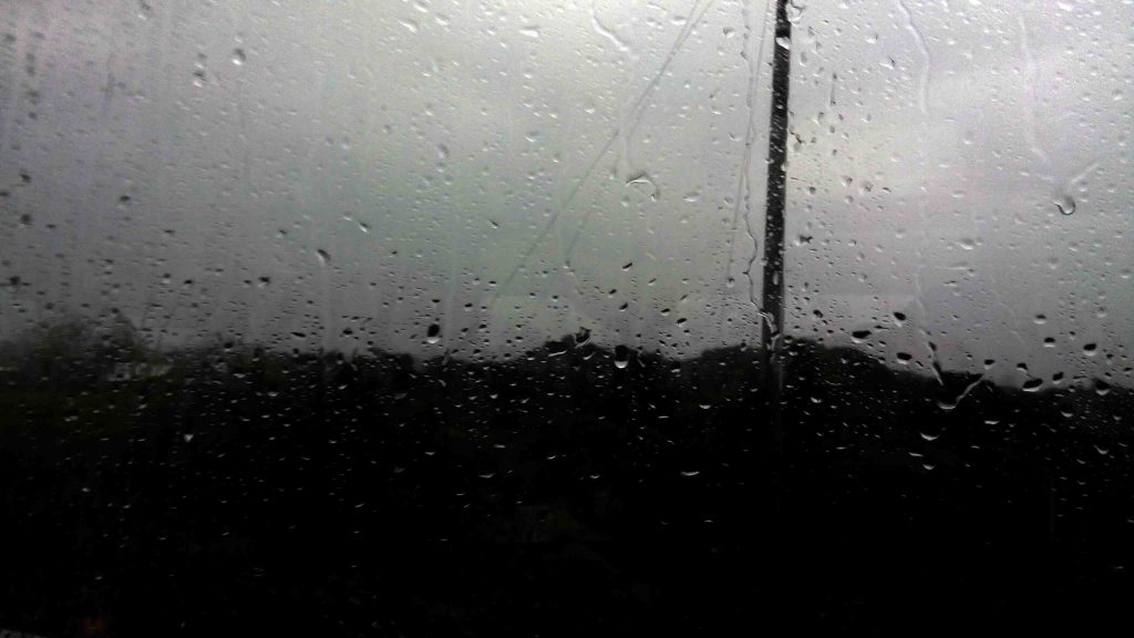
Whereas the northern countries go through four distinct seasons yearly, the tropics go through only two – wet and dry. Within each spell, however, are variables that make tropical living either seem like a paradise or a hell. Although flooding, droughts, eruptions and earthquakes are common occurrences all over the globe, especially with the so-called Climate Change, the actions and effects of water appear to be more pronounced, sustained and intense in the tropical islands than in other parts. Let us explain further.
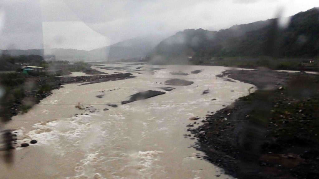
While snow, rain, tornadoes and hurricanes can occur often in the temperate regions for several months, rains and cyclones can occur throughout the year, although more often from June to October, with super-typhoons also seen from September to December. Every year, the loss or damage to life and property due to this endless cycle remains high, though one death is too high enough.
The recurring theme in all of this is the media network-news’ yearly-rehash of water shortage v.v. flooding. The water shortage occurs a couple of months just before the rainy season sets in and the flooding occurs as the rains arrive. We can always ascribe the tandem problems to poor or inadequate infrastructure throughout the archipelago, and that would also be true. However, it seems that we need a big dose of Isle Engineering to reduce these issues to a minimum, if not totally remove them. Is it too much to expect sufficient water supply in these islands that have water everywhere and so much more coming from the sky for months? Is it too selfish to ask for a flood-control system that finally works for a city that lies just beside the sea and yet has known floods for generations?
Corruption may come as the regular villain or scapegoat in this regard; however, even the developed nations have corrupt officials. Could it be that we follow the lead of those developed nations in planning our cities and in addressing our presumed “similar” problems? Or do we have unique problems that need to be seen and met independently of the rest of the world? Again, we ask: Are dams really appropriate for our “small” islands? Perhaps, in vast continental lands, dams may apply; but, they could be counterproductive for a water-logged archipelago. We will take a long look into this.
Impounding Water — Model Illustration
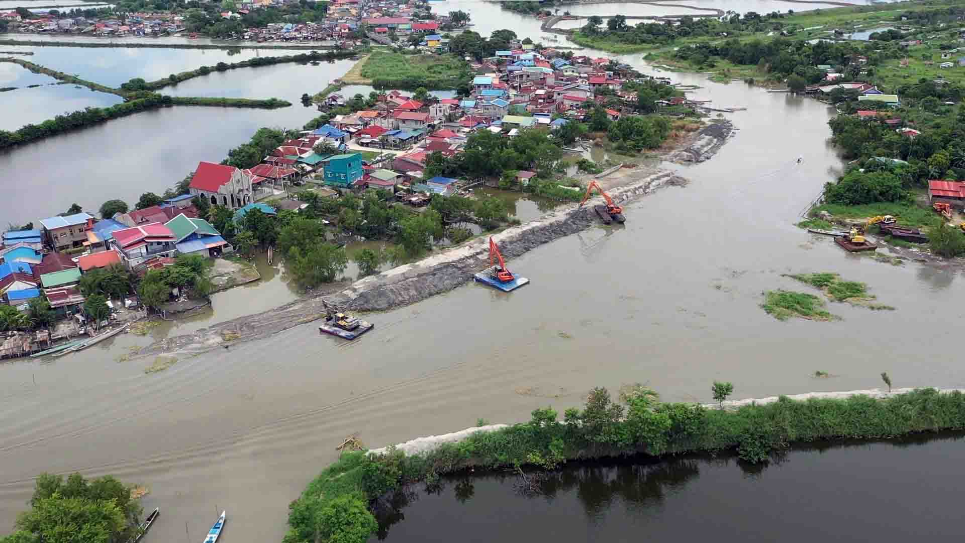
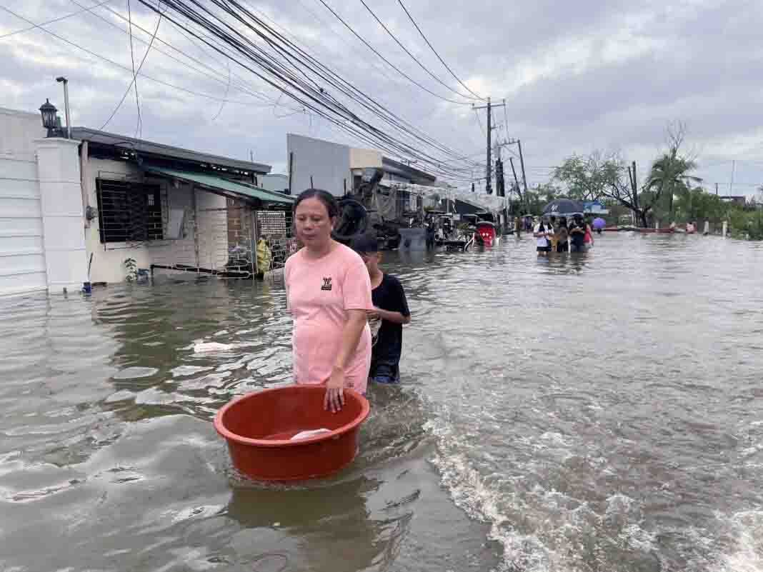
Before we dive into a possible real solution to our country’s water-resources and flooding woes, let us deal with a relevant and quite timely issue now hugging the headlines. The immediate question revolves around how to finally solve the flooding in Central Luzon, particularly the provinces of Pampanga and Bulacan which have been flooded for weeks now due to the recent Typhoon Egay. Even the President, Bongbong Marcos, Jr., has taken hands-on involvement with the problem by meeting with government officials of the affected areas in Pampanga. His and his officials’ general consensus, after the heated dialog, appears to be that of building impounding structures upstream and utilizing Candaba Swamp and other low areas as holding areas for floodwaters. We believe this is not the best solution. Our ultimate design will help our leaders see why. Meanwhile, let us illustrate, using a simple model, what a water-impounding structure is and how we attain its loading capacity.
For our model, let us assume we have a 1-hectare land, that is, 10,000 square meters. We further assume a rainfall rate of 1 meter over a 24-hour period falling on that 1 hectare. Multiplying the 2, the volume of water collected on that 1-hectare area will be 10,000 cubic meters (m3). If that area is flat and totally paved with concrete, people living within that area will be 1-meter deep in a flood. Of course, assuming the area is formed like a basin and the water has no means of flowing out. We use this simple illustration to show whether impounding water within that given area will be practical and economical. For if we expand the area to, say, 1,000 hectares, we will see and realize whether putting up dams or impounding water upstream is the best solution to the flooding in Central Luzon or any other region.
Back to our 1-hectare area. How do we store 10,000 cubic meters within one hectare? We could assign, say, 1,000 sqm for storing that amount of water, which leaves 9,000 sqm for other uses, such as for a garden, a house and others. Hence, with 1,000 sqm, in order to store 10,000 m3of water, our impounding tank must be 10 meters deep. In reality, however, all the water that falls on the land would be distributed to water that drains into the ground and water stored in plants or other natural-retaining systems, such as rivers, lakes, ponds and others. On the average, the surface runoff (water that flows out and over the land surface), accounts for only about 10%. That leaves us only 1,000 m3 of water on the surface. But that is only for a single day of rainfall. What if the rain falls 5 to 9 days, as it usually happens in Luzon? So, we average that to 7 days of rainfall that will accumulate and, thus, flood the area. Note, however, that an impounding system should have allowance for extreme conditions. That is, we can design for a 10-day, or longer, continuous rainfall. (As of this writing, Baguio has been under rain and clouds for 3 weeks already.)
But we use an average 7 days x 1,000 m3/day of water, a whole week of rainfall, or a total of 7,000 m3 of water to be impounded. It could actually be more than that because the ground, rivers, lakes and ponds will already be full after a few days and that increases the amount of surplus water runoff. We can then assume 10,000 m3 as a practical size for an impounding system. However, we can actually make a bigger impounding system to take advantage of the amount of water that is available. That is, we can allow water from surrounding areas, say 10 hectares to flow into our impounding system; so, we can then increase the amount of water we can store and use for the future. (Ideally, you need to store for the months when there is no rain, accounting for evaporation and leakage.) That would add an excess of another 10,000 m3 to our 10,000- m3 capacity. All in all, we have 20,000 m3 of water, or a structure that is 20 meters deep.
What we have done is basically what engineers do in designing a huge water reservoir that has a dam. In our case, we showed a scaled-down model which can be applied in a proportionate magnitude to cover several towns or even one or more provinces. But imagine the cost of a 1,000 sqm x 20 meter-deep structure even within a one-hectare lot? Multiply that 5 to 10 times, we can imagine the cost of building so many of such medium-sized impounding structures all over the archipelago. In reality, the area required to impound water may be much less than the 10% we used; however, it could mean inundating towns, fields and vital watershed areas that could otherwise be utilized for planting and preserving forest lands, ecosystems and animal, as well as aquatic resources. Balancing our need for water and conserving the natural environment is quite an extremely decision, like being caught between the devil and the deep blue sea.
This impounding strategy has its technical advantages as well as practical uses. But it is not the most efficient solution to the flooding issue and to the water-shortage problem we often encounter during rainy seasons. It can be integrated with another system that will absorb the bulk of the volume of water for storage and future use while reducing the costs of building infrastructure by building a system that is not nearly as expensive as building only so many impounding systems. A fully-integrated system can optimize the use of water and reduce the cost of storing and distributing water which we get free annually but which we have merely wasted for so long and even allowed it to destroy life and cause damage in our towns on its annual course.
Until now, sadly, we have not come up with an economical, efficient and viable system of water resources management and control. The solution needs to be adaptable and consistent with the archipelagic nature of our country. Most of all, it must fully take advantage of the ample, if not more-than-abundant and, literally, overflowing, blessing of water that Heaven pours upon us every year. Water, water everywhere and every year, but not a drop to drink in the dry season for many households!
We must end this shameful irony in the lives of our people and our nation.